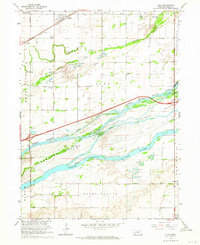
1962 Map of Alda
USGS Topo · Published 1964About this map
The Platte River braided channel system dominates this Hall County landscape, defining the character of the settlements and agricultural land during the early 1960s. The intricate network of waterways, including the North Channel Platte River, Middle Channel Platte River, and South Channel Platte River, carves out large landmasses such as Shoemaker Island and Mormon Island. These river features dictated the development of the region, creating a distinctive geography where the Union Pacific railroad and the burgeoning path of Interstate 80 follow the natural contours of the valley.
Find a feature on this map
30 named features on this map. Tap any name to fly to it.
Don’t see what you’re looking for? This feature index may not catch every label — zoom into the map to look around manually.
Map Details
Editions of this 1962 Alda Map
3 editions found
Other maps of this area

1892 · Grand Island
USGS Topo · 1:62,500

1894 · Kenesaw
USGS Topo · 1:62,500

1895 · Grand Island
USGS Topo · 1:62,500

1895 · Wood River
USGS Topo · 1:62,500

1896 · Wood River
USGS Topo · 1:125,000

1898 · Grand Island
USGS Topo · 1:125,000

1955 · Grand Island
USGS Topo · 1:250,000

1957 · Grand Island
USGS Topo · 1:250,000

1958 · Grand Island
USGS Topo · 1:250,000

1962 · Prosser
USGS Topo · 1:24,000