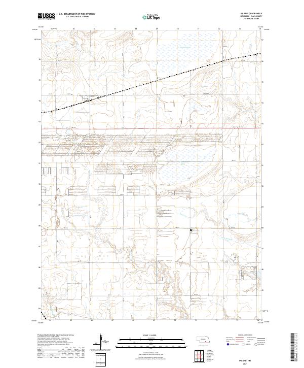
2021 Map of Inland
USGS Topo · Published 2021About this map
The small settlement of Inland stands at a quiet crossroads in the northern portion of this Clay County landscape, where the township grid meets a high-density cluster of irrigation or industrial structures. This modern survey illustrates the intensive agricultural modification of the Nebraska plains, characterized by long, linear developments and the preservation of crucial wetland habitats. Among these are the substantial Harvard Marsh and McMurtrey Marsh, which break the geometric precision of the section lines. The drainage of the region is defined by several seasonal waterways, including School Creek, Little Sandy Creek, and Big Sandy Creek, which weave through the southern sections. Local history is anchored by the Zion Cemetery, a key landmark for genealogical research located along Road 314 near the convergence of several township boundaries.
Find a feature on this map
24 named features on this map. Tap any name to fly to it.
Don’t see what you’re looking for? This feature index may not catch every label — zoom into the map to look around manually.
Map Details
Editions of this 2021 Inland Map
This is the sole edition of this map. No revisions or reprints were ever made.
Other maps of this area

1898 · Superior
USGS Topo · 1:125,000

1898 · Grand Island
USGS Topo · 1:125,000

1955 · Grand Island
USGS Topo · 1:250,000

1957 · Grand Island
USGS Topo · 1:250,000

1958 · Grand Island
USGS Topo · 1:250,000

1969 · Hastings East
USGS Topo · 1:24,000

1969 · Fairfield NW
USGS Topo · 1:24,000
1969 · Trumbull
USGS Topo · 1:24,000
1969 · Fairfield
USGS Topo · 1:24,000
1969 · Harvard NE
USGS Topo · 1:24,000