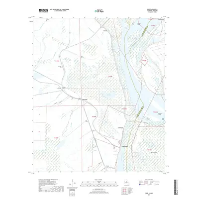
2018 Map of Innis
USGS Topo · Published 2018About this map
Bayou Lettsworth snakes through this alluvial landscape, marking a terrain defined by the complex hydrography of the Mississippi River and its ancient overflow channels. Small rural settlements like Lettsworth, Torras, and Williamsport are positioned along the higher ground of the levees, surrounded by a dense network of swampy backwaters and lakes such as Big Lake Moreau and Little Lake Moreau. The land is fragmented by numerous cutoffs and bars, including Shreves Cutoff and Miles Bar, which trace the river's historical migration.
Find a feature on this map
63 named features on this map. Tap any name to fly to it.
Don’t see what you’re looking for? This feature index may not catch every label — zoom into the map to look around manually.
Map Details
Editions of this 2018 Innis Map
This is the sole edition of this map. No revisions or reprints were ever made.
Other maps of this area

1939 · Artonish
USGS Topo · 1:62,500

1941 · Voorhies
USGS Topo · 1:62,500

1941 · Batchelor
USGS Topo · 1:62,500

1953 · Natchez
USGS Topo · 1:250,000

1954 · Artonish
USGS Topo · 1:62,500

1954 · Baton Rouge
USGS Topo · 1:250,000

1955 · Artonish
USGS Topo · 1:62,500

1955 · Batchelor
USGS Topo · 1:62,500

1955 · Odenburg
USGS Topo · 1:62,500

1956 · Natchez
USGS Topo · 1:250,000