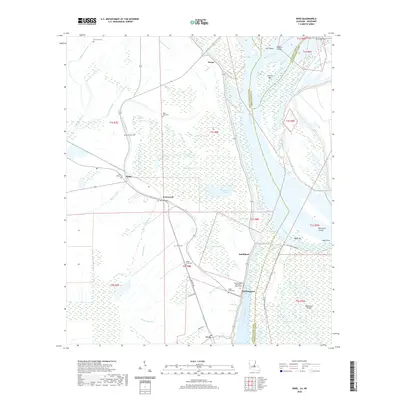
2020 Map of Innis
USGS Topo · Published 2020About this map
Lettsworth and Williamsport anchor a landscape defined by the shifting course of the Mississippi River in northern Pointe Coupee Parish. This modern record of the river's hydrology shows the complex network of oxbows and cutoffs, including Raccourci Old River and the Shreves Cutoff, which have shaped the low-lying terrain. The area is dotted with numerous local burial grounds, such as Saint Stephens Episcopal Church Cem, Sunnyside Cem, and Pikes Peak Cem, providing significant geographic markers for genealogical research.
Find a feature on this map
56 named features on this map. Tap any name to fly to it.
Don’t see what you’re looking for? This feature index may not catch every label — zoom into the map to look around manually.
Map Details
Editions of this 2020 Innis Map
This is the sole edition of this map. No revisions or reprints were ever made.
Other maps of this area

1939 · Artonish
USGS Topo · 1:62,500

1941 · Voorhies
USGS Topo · 1:62,500

1941 · Batchelor
USGS Topo · 1:62,500

1953 · Natchez
USGS Topo · 1:250,000

1954 · Artonish
USGS Topo · 1:62,500

1954 · Baton Rouge
USGS Topo · 1:250,000

1955 · Artonish
USGS Topo · 1:62,500

1955 · Batchelor
USGS Topo · 1:62,500

1955 · Odenburg
USGS Topo · 1:62,500

1956 · Natchez
USGS Topo · 1:250,000