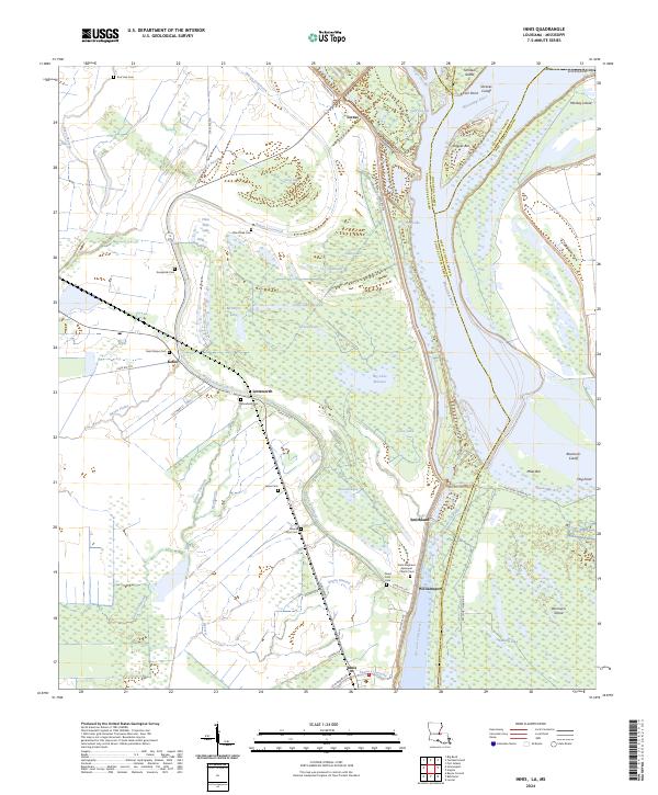
2024 Map of Innis
USGS Topo · Published 2024About this map
Mississippi River meanders define the complex hydrology of this Pointe Coupee Parish landscape, where historical river shifts have created a series of cutoffs and remnant lakes. The community of Lettsworth sits at a geographic bend, surrounded by a dense network of water bodies including Big Lake Moreau, Clear Lake, and McIntyre Lake. This area is particularly rich for genealogical research, featuring numerous small burial grounds such as Morefield Cem, Mount Olive Cem, and the Saint Stephens Episcopal Church Cem near Williamsport. The landscape is a mosaic of bayous and former river channels, with Raccourci Old River and Shreves Cutoff illustrating the constant evolution of the delta. Land use is largely governed by the proximity to these waterways, with local roads like State Rte 418 and Gayden Rd connecting established settlements like Innis and Torras through the low-lying terrain.
Find a feature on this map
68 named features on this map. Tap any name to fly to it.
Don’t see what you’re looking for? This feature index may not catch every label — zoom into the map to look around manually.
Map Details
Editions of this 2024 Innis Map
This is the sole edition of this map. No revisions or reprints were ever made.
Other maps of this area

1939 · Artonish
USGS Topo · 1:62,500

1941 · Voorhies
USGS Topo · 1:62,500

1941 · Batchelor
USGS Topo · 1:62,500

1953 · Natchez
USGS Topo · 1:250,000

1954 · Artonish
USGS Topo · 1:62,500

1954 · Baton Rouge
USGS Topo · 1:250,000

1955 · Artonish
USGS Topo · 1:62,500

1955 · Batchelor
USGS Topo · 1:62,500

1955 · Odenburg
USGS Topo · 1:62,500

1956 · Natchez
USGS Topo · 1:250,000