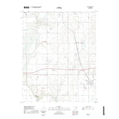
2019 Map of Inola
USGS Topo · Published 2019About this map
Inola serves as the primary hub of this eastern Oklahoma landscape, positioned at a historic crossroads where the prairie meets the intricate waterways of the Verdigris River valley. The river dominates the western margin, creating a complex of oxbows and wetlands including Horseshoe Lake, Little Flag Lake, and Big Flag Lake. This topography transitions into the expansive Big Bottom near the southern boundary, where the river winds toward the Rogers and Wagoner County line.
Find a feature on this map
71 named features on this map. Tap any name to fly to it.
Don’t see what you’re looking for? This feature index may not catch every label — zoom into the map to look around manually.
Map Details
Editions of this 2019 Inola Map
This is the sole edition of this map. No revisions or reprints were ever made.
Other maps of this area

1896 · Pryor
USGS Topo · 1:125,000

1901 · Claremore
USGS Topo · 1:125,000

1901 · Pryor
USGS Topo · 1:125,000

1914 · Claremore
USGS Topo · 1:125,000

1916 · Claremore
USGS Topo · 1:125,000

1954 · Tulsa
USGS Topo · 1:250,000

1958 · Tulsa
USGS Topo · 1:250,000

1963 · Tulsa
USGS Topo · 1:250,000
1963 · Neodesha
USGS Topo · 1:24,000
1963 · Oneta
USGS Topo · 1:24,000