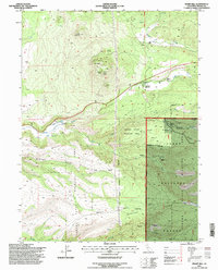
1995 Map of Inskip Hill
USGS Topo · Published 1998About this map
The volcanic landscape of the southern Cascade foothills dominates this region, anchored by the prominent Inskip Hill and the nearby Inskip Caves. The terrain is deeply incised by drainages such as De Haven Gulch and Paynes Creek, reflecting a geology defined by the Hogback Ridge. This area serves as a significant conservation corridor, with much of the land managed within the Tehama State Wildlife Area and the western edge of the Lassen National Forest.
Find a feature on this map
37 named features on this map. Tap any name to fly to it.
Don’t see what you’re looking for? This feature index may not catch every label — zoom into the map to look around manually.
Map Details
Editions of this 1995 Inskip Hill Map
This is the sole edition of this map. No revisions or reprints were ever made.
Other maps of this area

1886 · Lassen Peak
USGS Topo · 1:250,000

1890 · Red Bluff
USGS Topo · 1:250,000

1892 · Lassen Peak
USGS Topo · 1:250,000

1894 · Lassen Peak
USGS Topo · 1:250,000

1894 · Red Bluff
USGS Topo · 1:250,000

1905 · Tehama
USGS Topo · 1:62,500

1935 · Paynes Creek
USGS Topo · 1:96,000

1941 · Mineral
USGS Topo · 1:125,000

1944 · Tuscan Buttes
USGS Topo · 1:62,500

1947 · Tuscan Buttes
USGS Topo · 1:62,500