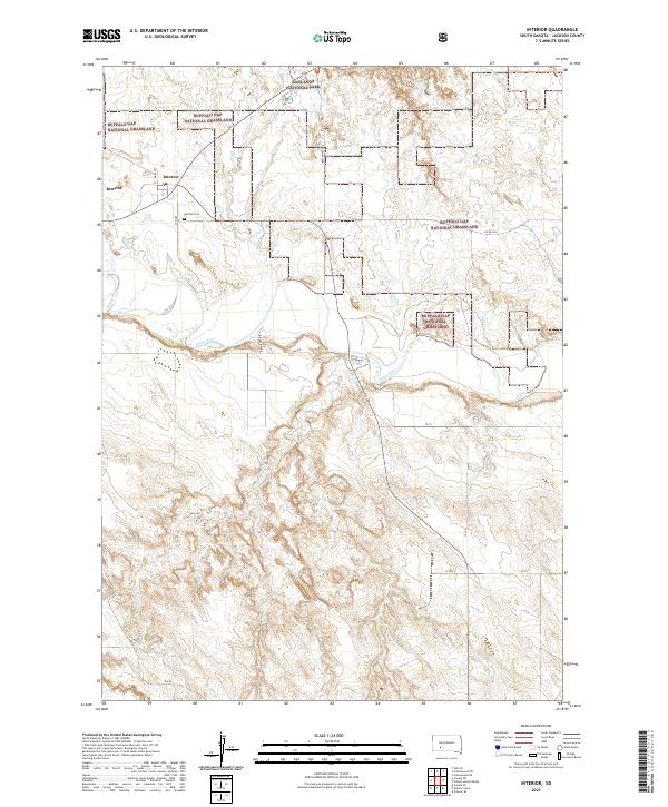
2021 Map of Interior
USGS Topo · Published 2021About this map
Interior serves as a small gateway to the surrounding wilderness, situated at the intersection of local routes like Main St and 6th Ave. The settlement is bordered by the sprawling protected landscapes of Buffalo Gap National Grassland and Badlands National Park, where the terrain begins its characteristic drop into the breaks of the White River valley. To the south, the river meanders through the landscape, joined by tributaries such as Sixteenmile Cr. The proximity of the Interior Cem just outside the town center provides a point of interest for those researching local lineage. Transport corridors like the Ben Reifel Pkwy and T K Sampson Rd connect this outpost to the broader Jackson County landscape, revealing a region defined by federal land management and its relationship with the river.
Find a feature on this map
26 named features on this map. Tap any name to fly to it.
Don’t see what you’re looking for? This feature index may not catch every label — zoom into the map to look around manually.
Map Details
Editions of this 2021 Interior Map
This is the sole edition of this map. No revisions or reprints were ever made.
Other maps of this area

1950 · Interior
USGS Topo · 1:24,000

1950 · Interior SE
USGS Topo · 1:24,000

1950 · Potato Creek
USGS Topo · 1:24,000

1951 · School Section Butte
USGS Topo · 1:24,000

1952 · Conata NE
USGS Topo · 1:24,000

1952 · Conata SE
USGS Topo · 1:24,000

1955 · Hot Springs
USGS Topo · 1:250,000

1955 · Martin
USGS Topo · 1:250,000

1958 · Martin
USGS Topo · 1:250,000

1960 · Wall SE
USGS Topo · 1:24,000