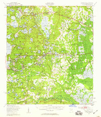
1949 Map of Interlachen
USGS Topo · Published 1959About this map
Interlachen serves as the central hub of this north-central Florida landscape, where a dense network of lakes and prairies dictates the pattern of mid-century settlement. The Atlantic Coast Line and Southern Ry railroads cut through the terrain, connecting rail towns like Grandin, Florahome, and Putnam Hall. The map reveals a land defined by water, from the expansive Lake Grandin and Cowpen Lake to the marshy stretches of Goodson Prairie and Putnam Prairie.
Find a feature on this map
119 named features on this map. Tap any name to fly to it.
Don’t see what you’re looking for? This feature index may not catch every label — zoom into the map to look around manually.
Map Details
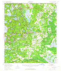
Editions of this 1949 Interlachen Map
3 editions found

Other maps of this area

1893 · Citra
USGS Topo · 1:62,500

1895 · Citra
USGS Topo · 1:62,500

1912 · Palatka
USGS Topo · 1:48,000

1915 · Palatka
USGS Topo · 1:62,500

1915 · Interlachen
USGS Topo · 1:48,000

1916 · Interlachen
USGS Topo · 1:62,500

1938 · Hawthorn
USGS Topo · 1:48,000

1941 · Starke
USGS Topo · 1:62,500

1942 · Ates Creek
USGS Topo · 1:62,500

1943 · Hawthorn
USGS Topo · 1:62,500