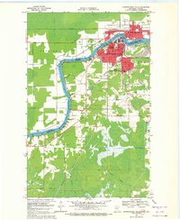
1969 Map of International Falls
USGS Topo · Published 1972About this map
Rainy River defines the international border here, separating the industrial centers of Fort Frances, Ontario, and International Falls, Minnesota. This late-1960s snapshot shows a landscape dominated by timber-related transportation and public infrastructure, featuring the sprawling Falls International Airport and the educational campus of Rainy River State Jr College. The map captures a dense network of institutional landmarks, from the Filtration Plant and Sewage Disp facilities to the US Customs station at the bridge.
Find a feature on this map
33 named features on this map. Tap any name to fly to it.
Don’t see what you’re looking for? This feature index may not catch every label — zoom into the map to look around manually.
Map Details
Editions of this 1969 International Falls Map
2 editions found
Other maps of this area

1919 · Pelland
USGS Topo · 1:62,500

1919 · Happy Land
USGS Topo · 1:62,500

1919 · International Falls
USGS Topo · 1:62,500

1954 · International Falls
USGS Topo · 1:250,000

1957 · International Falls
USGS Topo · 1:250,000

1958 · International Falls
USGS Topo · 1:250,000

1963 · Ranier
USGS Topo · 1:24,000

1969 · Ericsburg NW
USGS Topo · 1:24,000

1969 · Ericsburg
USGS Topo · 1:24,000

1969 · Ranier
USGS Topo · 1:24,000