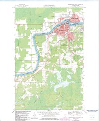
1969 Map of International Falls
USGS Topo · Published 1983About this map
Rainy River serves as the international boundary between International Falls, Minnesota, and Fort Frances, Ontario, in this 1969 topographic survey. The urban character of the twin border towns is highly detailed, showing industrial landmarks like the Filtration Plant and the Minnesota Dakota and Western rail line. To the south, the landscape transitions toward South International Falls and the more rural settlement of Nakoda.
Find a feature on this map
35 named features on this map. Tap any name to fly to it.
Don’t see what you’re looking for? This feature index may not catch every label — zoom into the map to look around manually.
Map Details
Editions of this 1969 International Falls Map
2 editions found
Other maps of this area

1919 · Pelland
USGS Topo · 1:62,500

1919 · Happy Land
USGS Topo · 1:62,500

1919 · International Falls
USGS Topo · 1:62,500

1954 · International Falls
USGS Topo · 1:250,000

1957 · International Falls
USGS Topo · 1:250,000

1958 · International Falls
USGS Topo · 1:250,000

1963 · Ranier
USGS Topo · 1:24,000

1969 · Ericsburg NW
USGS Topo · 1:24,000

1969 · Ericsburg
USGS Topo · 1:24,000

1969 · Ranier
USGS Topo · 1:24,000