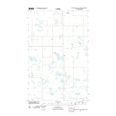
2011 Map of International Peace Garden
USGS Topo · Published 2011About this map
The Turtle Mountains rise above a landscape defined by an intricate network of glacial lakes and prairie potholes in this northern Rolette County study. The settlement of Kelvin and the surrounding area of Little Prairie sit near the international border, where the Intl Peace Gdn and its associated International Peace Garden Airfield provide a unique cross-border landmark. The terrain is dominated by water, from the larger expanses of Berry Lake and Long Lake to smaller named bodies like Rabbit City Lake and Eldridge Lake.
Find a feature on this map
36 named features on this map. Tap any name to fly to it.
Don’t see what you’re looking for? This feature index may not catch every label — zoom into the map to look around manually.
Map Details
Editions of this 2011 International Peace Garden Map
This is the sole edition of this map. No revisions or reprints were ever made.
Other maps of this area

1935 · Dunseith
USGS Topo · 1:48,000

1936 · Lake Upsilon
USGS Topo · 1:48,000

1939 · Dunseith
USGS Topo · 1:62,500

1942 · Lake Upsilon
USGS Topo · 1:62,500

1953 · Devils Lake
USGS Topo · 1:250,000

1954 · Minot
USGS Topo · 1:250,000

1955 · Lords Lake
USGS Topo · 1:24,000

1955 · Dunseith
USGS Topo · 1:24,000

1955 · Lake Upsilon SW
USGS Topo · 1:24,000

1956 · Devils Lake
USGS Topo · 1:250,000