
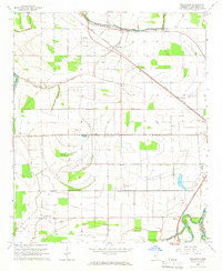
1965 Map of Inverness
USGS Topo · Published 1966About this map
Illinois Central rails anchor the corridor between Inverness and Isola in this mid-1960s study of the Mississippi Delta. The landscape is defined by the winding course of Dawson Lake and the complex drainage of the Mound Bayou, Short Indian Bayou, and Jackson Bayou. Culturally, the map reveals a network of rural faith and community centers, including McGinnis Chapel, St Lawrence Ch, and Mt Center Ch. Traces of earlier habitation are evident at Mt Moriah Mound and an unnamed Indian Mound near the banks of Sky Lake. The map details a transition from rail-dependent agriculture to more modern infrastructure, noting the presence of the Lester Airstrip and numerous pipelines cutting through the alluvial plain.
Find a feature on this map
46 named features on this map. Tap any name to fly to it.
Don’t see what you’re looking for? This feature index may not catch every label — zoom into the map to look around manually.
Map Details
Editions of this 1965 Inverness Map
This is the sole edition of this map. No revisions or reprints were ever made.
Other maps of this area

1940 · Auter
USGS Topo · 1:62,500

1940 · Baird
USGS Topo · 1:62,500

1940 · Mileston
USGS Topo · 1:62,500

1953 · Greenwood
USGS Topo · 1:250,000

1954 · Mileston
USGS Topo · 1:62,500

1956 · Greenwood
USGS Topo · 1:250,000

1961 · Mossy Lake
USGS Topo · 1:62,500

1965 · Indianola
USGS Topo · 1:24,000

1965 · Kinlock
USGS Topo · 1:24,000
1965 · Bellewood
USGS Topo · 1:24,000