
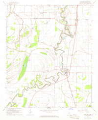
1965 Map of Indianola
USGS Topo · Published 1966About this map
Indianola stands as the central hub of this Mississippi Delta landscape in the mid-1960s, its urban grid tightly clustered north of the meandering Big Sunflower River. The town's social and educational infrastructure is well-defined, featuring landmarks such as the Carver Sch, High Sch, and the local Hospital. To the west, the community of Heathman sits along the Columbus and Greenville railroad line, illustrating the region's historical reliance on rail for transport and commerce.
Find a feature on this map
35 named features on this map. Tap any name to fly to it.
Don’t see what you’re looking for? This feature index may not catch every label — zoom into the map to look around manually.
Map Details
Editions of this 1965 Indianola Map
This is the sole edition of this map. No revisions or reprints were ever made.
Other maps of this area

1934 · Cleveland
USGS Topo · 1:62,500

1939 · Tralake
USGS Topo · 1:62,500

1939 · Choctaw
USGS Topo · 1:62,500

1940 · Baird
USGS Topo · 1:62,500

1940 · Cleveland
USGS Topo · 1:62,500

1953 · Greenwood
USGS Topo · 1:250,000

1956 · Greenwood
USGS Topo · 1:250,000

1965 · Inverness
USGS Topo · 1:24,000

1965 · Kinlock
USGS Topo · 1:24,000
1966 · Sunflower
USGS Topo · 1:24,000