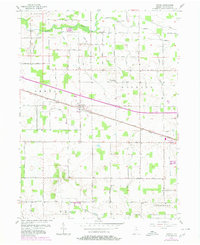
1957 Map of Inwood
USGS Topo · Published 1980About this map
Inwood and Bourbon anchor this Marshall County landscape during the late 1950s, a period defined by the steady rail traffic of the Conrail line and the historic path of the Lincoln Highway. The terrain is shaped by the southern flow of the Tippecanoe River and the meandering Yellow River, which cut through a grid of rural roads like Dausman Road and N Filbert Rd.
Find a feature on this map
36 named features on this map. Tap any name to fly to it.
Don’t see what you’re looking for? This feature index may not catch every label — zoom into the map to look around manually.
Map Details
Editions of this 1957 Inwood Map
Other maps of this area

1953 · Chicago
USGS Topo · 1:250,000

1957 · Chicago
USGS Topo · 1:250,000

1957 · Inwood
USGS Topo · 1:24,000

1957 · Plymouth
USGS Topo · 1:24,000

1958 · Bremen
USGS Topo · 1:24,000

1958 · La Paz
USGS Topo · 1:24,000

1958 · Nappanee West
USGS Topo · 1:24,000

1958 · Bourbon
USGS Topo · 1:24,000

1959 · Mentone
USGS Topo · 1:24,000

1962 · Argos
USGS Topo · 1:24,000