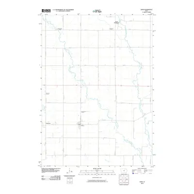
2010 Map of Ionia
USGS Topo · Published 2010About this map
The winding Wapsipinicon River defines the central geography of this portion of Chickasaw County, carving a serpentine path through a landscape dominated by a precise section-line road grid. The settlement of Ionia serves as a local hub, anchored by the Ionia Post Office, while the neighboring village of Chickasaw sits to the west. This area preserves a high density of rural heritage sites, including three distinct burial grounds: Saint Marys Cemetery in the north, Saint Boniface Cemetery near the center, and Rowley Hill Cemetery on the western edge. The drainage network is complex, featuring the Little Wapsipinicon River and Etter Creek, showing how the natural hydrology of the Iowan Surface persists alongside a deeply established agricultural infrastructure. Small-town centers like North Washington and public points like the North Waspi Access illustrate the mix of community life and river-based recreation.
Find a feature on this map
29 named features on this map. Tap any name to fly to it.
Don’t see what you’re looking for? This feature index may not catch every label — zoom into the map to look around manually.
Map Details
Editions of this 2010 Ionia Map
This is the sole edition of this map. No revisions or reprints were ever made.
Other maps of this area

1954 · Mason City
USGS Topo · 1:250,000

1954 · Waterloo
USGS Topo · 1:250,000

1955 · Waterloo
USGS Topo · 1:250,000

1957 · Mason City
USGS Topo · 1:250,000

1958 · Mason City
USGS Topo · 1:250,000

1971 · Tripoli NW
USGS Topo · 1:24,000

1971 · Frederika
USGS Topo · 1:24,000

1971 · Bassett
USGS Topo · 1:24,000

1971 · Colwell
USGS Topo · 1:24,000
1971 · Nashua
USGS Topo · 1:24,000