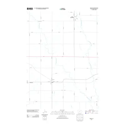
2013 Map of Ionia
USGS Topo · Published 2013About this map
The Wapsipinicon River and its sister, the Little Wapsipinicon River, dominate this Chickasaw County landscape, carving winding paths through a grid of rural section roads. The settlement of Ionia sits centrally near the banks of Dry Run, serving as a focal point for the surrounding agricultural community. To the north, the small village of North Washington is laid out along N Gilmore Ave and Pine St, while the community of Chickasaw appears on the western edge of the map. This 2013 survey illustrates the enduring rural character of northeast Iowa, where small towns remain anchored by the river system and historical access points like the North Wapsi Access. The landscape is largely defined by its drainage, with Etter Cr and various unnamed tributaries feeding into the larger river valleys that have shaped local transport and settlement patterns for generations.
Find a feature on this map
39 named features on this map. Tap any name to fly to it.
Don’t see what you’re looking for? This feature index may not catch every label — zoom into the map to look around manually.
Map Details
Editions of this 2013 Ionia Map
This is the sole edition of this map. No revisions or reprints were ever made.
Other maps of this area

1954 · Mason City
USGS Topo · 1:250,000

1954 · Waterloo
USGS Topo · 1:250,000

1955 · Waterloo
USGS Topo · 1:250,000

1957 · Mason City
USGS Topo · 1:250,000

1958 · Mason City
USGS Topo · 1:250,000

1971 · Tripoli NW
USGS Topo · 1:24,000

1971 · Frederika
USGS Topo · 1:24,000

1971 · Bassett
USGS Topo · 1:24,000

1971 · Colwell
USGS Topo · 1:24,000
1971 · Nashua
USGS Topo · 1:24,000