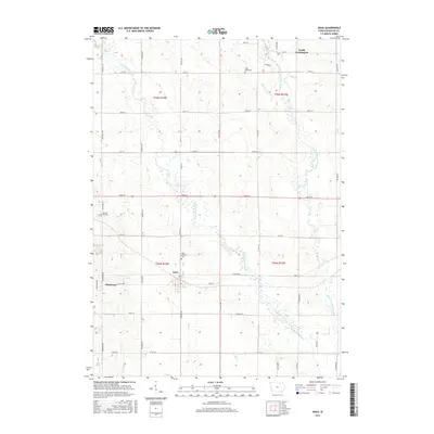
2015 Map of Ionia
USGS Topo · Published 2015About this map
The Wapsipinicon River and Little Wapsipinicon River dominate this portion of Chickasaw County, weaving through a landscape defined by long-established agricultural boundaries. The town of Ionia serves as a central point in the southern half of the map, while the smaller settlement of North Washington occupies the northern edge. These communities remain anchored by local landmarks such as Saint Boniface Cem and Saint Marys Cem, which reflect the area's genealogical history. The map also traces the smaller drainage patterns of Dry Run and Bitter Cr, illustrating how the township and range system, including t95n r14w, has organized the land into a precise grid of roads like Exeter Ave and Durham Ave. This 2015 survey provides a modern look at the enduring rural layout of these Iowa townships.
Find a feature on this map
42 named features on this map. Tap any name to fly to it.
Don’t see what you’re looking for? This feature index may not catch every label — zoom into the map to look around manually.
Map Details
Editions of this 2015 Ionia Map
This is the sole edition of this map. No revisions or reprints were ever made.
Other maps of this area

1954 · Mason City
USGS Topo · 1:250,000

1954 · Waterloo
USGS Topo · 1:250,000

1955 · Waterloo
USGS Topo · 1:250,000

1957 · Mason City
USGS Topo · 1:250,000

1958 · Mason City
USGS Topo · 1:250,000

1971 · Tripoli NW
USGS Topo · 1:24,000

1971 · Frederika
USGS Topo · 1:24,000

1971 · Bassett
USGS Topo · 1:24,000

1971 · Colwell
USGS Topo · 1:24,000
1971 · Nashua
USGS Topo · 1:24,000