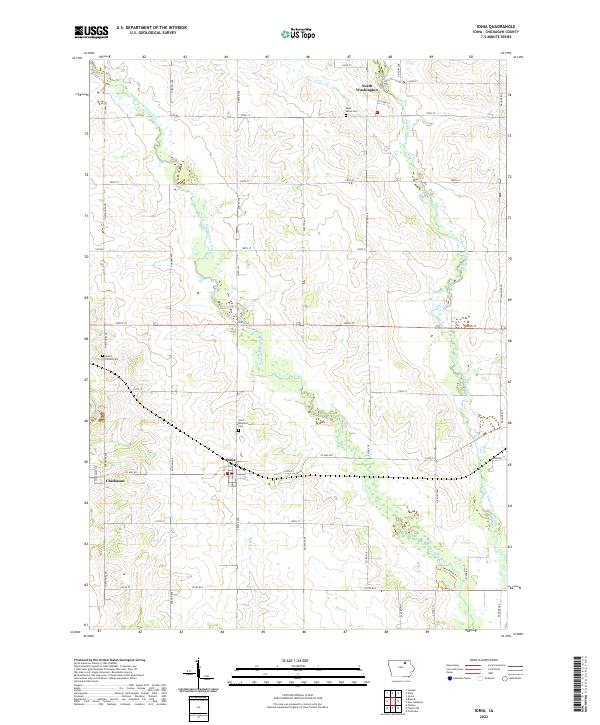
2022 Map of Ionia
USGS Topo · Published 2022About this map
The Wapsipinicon River and Little Wapsipinicon River converge in this section of Chickasaw County, shaping a landscape defined by alluvial drainage and agricultural grid lines. The village of Ionia sits near the center of the sheet, served by Co Hwy B57 and Exeter Ave. To the north, the small settlement of North Washington is anchored by Saint Marys Cem, while the hamlet of Chickasaw occupies the western edge along the riverbanks. This 2022 survey details the persistent rural character of the region, where legacy landmarks like Saint Boniface Cem and Mount Carroll Cem mark the heritage of early Iowa parishes. The drainage patterns of Dry Run and Etter Cr intersect with a modern road network, including the Twin Ponds Trl, illustrating the contemporary use of this river-valley terrain.
Find a feature on this map
41 named features on this map. Tap any name to fly to it.
Don’t see what you’re looking for? This feature index may not catch every label — zoom into the map to look around manually.
Map Details
Editions of this 2022 Ionia Map
This is the sole edition of this map. No revisions or reprints were ever made.
Other maps of this area

1954 · Mason City
USGS Topo · 1:250,000

1954 · Waterloo
USGS Topo · 1:250,000

1955 · Waterloo
USGS Topo · 1:250,000

1957 · Mason City
USGS Topo · 1:250,000

1958 · Mason City
USGS Topo · 1:250,000

1971 · Tripoli NW
USGS Topo · 1:24,000

1971 · Frederika
USGS Topo · 1:24,000

1971 · Bassett
USGS Topo · 1:24,000

1971 · Colwell
USGS Topo · 1:24,000
1971 · Nashua
USGS Topo · 1:24,000