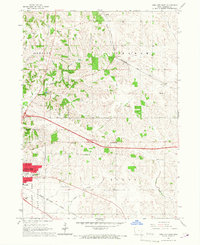
1965 Map of Iowa City East
USGS Topo · Published 1967About this map
The Chicago Rock Island and Pacific railroad cuts a diagonal path across this landscape, connecting small agricultural hubs like Morse, Elmira, and Oasis as they appeared in the mid-1960s. On the western edge, the Iowa City Corporate Boundary begins to push eastward, marked by the development of Memory Gardens Cem and the Southeast Jr High Sch. This era captures a rural school system in transition, still showing numerous country schoolhouses such as Railroad Sch, Carthage Sch, and Center Sch scattered among the townships.
Find a feature on this map
34 named features on this map. Tap any name to fly to it.
Don’t see what you’re looking for? This feature index may not catch every label — zoom into the map to look around manually.
Map Details
Editions of this 1965 Iowa City East Map
Other maps of this area

1887 · Cedar Rapids
USGS Topo · 1:62,500

1891 · Mechanicsville
USGS Topo · 1:62,500

1891 · Cedar Rapids
USGS Topo · 1:62,500

1891 · Iowa City
USGS Topo · 1:62,500

1894 · Mechanicsville
USGS Topo · 1:62,500

1894 · West Liberty
USGS Topo · 1:62,500

1901 · Stanwood
USGS Topo · 1:125,000

1903 · Fairfax
USGS Topo · 1:125,000

1938 · Iowa City
USGS Topo · 1:62,500

1958 · Davenport
USGS Topo · 1:250,000