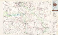
1984 Map of Iowa City
USGS Topo · Published 1985About this map
Cedar Rapids and Iowa City anchor this mid-1980s map of eastern Iowa, a region defined by the winding paths of the Cedar River and the Iowa River. The landscape reflects a mix of growing urban centers and expansive conservation areas, including the Hawkeye State Wildlife Management Area and the Palisades-Kepler State Park. Educational and infrastructure hubs are well-established, with Kirkwood Community College and the Cedar Rapids Municipal Airport serving as focal points for regional development.
Find a feature on this map
139 named features on this map. Tap any name to fly to it.
Don’t see what you’re looking for? This feature index may not catch every label — zoom into the map to look around manually.
Map Details
Editions of this 1984 Iowa City Map
2 editions found
Other maps of this area

1887 · Cedar Rapids
USGS Topo · 1:62,500

1888 · Shellsburg
USGS Topo · 1:62,500

1888 · Marion
USGS Topo · 1:62,500

1888 · Amana
USGS Topo · 1:62,500

1889 · Tipton
USGS Topo · 1:62,500

1889 · Marion
USGS Topo · 1:62,500

1889 · Amana
USGS Topo · 1:62,500

1889 · Shellsburg
USGS Topo · 1:62,500

1890 · Durant
USGS Topo · 1:62,500

1890 · Tipton
USGS Topo · 1:62,500