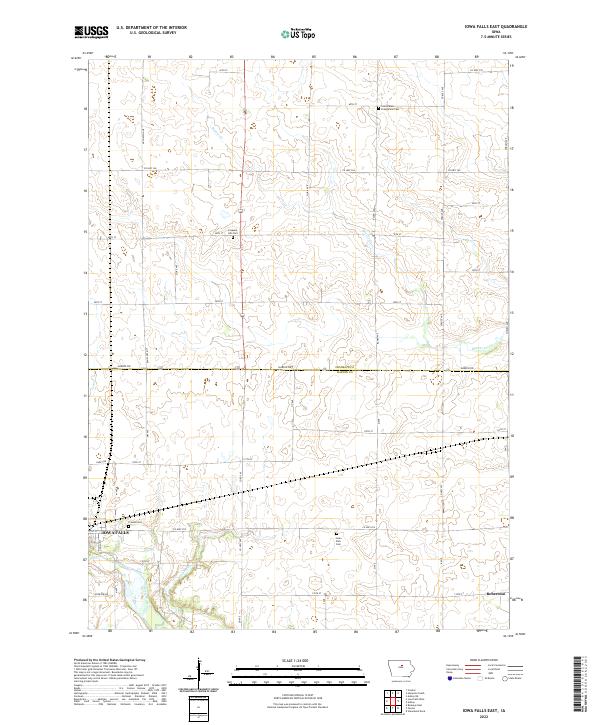
2022 Map of Iowa Falls East
USGS Topo · Published 2022About this map
Iowa Falls serves as the focal point for this survey of the central Iowa heartland, where the Iowa River cuts through the southwestern corner of the quadrangle. The landscape is defined by the rectilinear grid of county roads and section lines that characterize the transition from Franklin County to Hardin County. Evidence of early community life is preserved in the distribution of rural burial grounds, including Saint Peters Evangelical Cem in the north and the Friends Cem near the river. The small settlement of Robertson sits in the southeast, positioned along the transport corridor that follows the gentle drainages of School Creek. This modern record captures the enduring agricultural layout of the region, where waterways like Beaver Creek wind through the township divisions of T90N and T89N, providing a baseline for tracking land ownership and local genealogy in these two counties.
Find a feature on this map
31 named features on this map. Tap any name to fly to it.
Don’t see what you’re looking for? This feature index may not catch every label — zoom into the map to look around manually.
Map Details
Editions of this 2022 Iowa Falls East Map
This is the sole edition of this map. No revisions or reprints were ever made.
Other maps of this area

1954 · Waterloo
USGS Topo · 1:250,000

1955 · Waterloo
USGS Topo · 1:250,000

1979 · Ackley NE
USGS Topo · 1:24,000

1979 · Coulter
USGS Topo · 1:24,000

1979 · Iowa Falls West
USGS Topo · 1:24,000

1979 · Buckeye East
USGS Topo · 1:24,000

1979 · Ackley
USGS Topo · 1:24,000

1979 · Steamboat Rock
USGS Topo · 1:24,000

1979 · Iowa Falls East
USGS Topo · 1:24,000
1979 · Hampton South
USGS Topo · 1:24,000