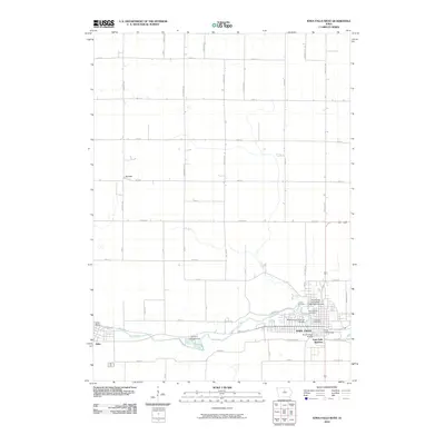
2010 Map of Iowa Falls West
USGS Topo · Published 2010About this map
Iowa Falls serves as the focal point of this 2010 topographic survey, centered on the winding path of the Iowa River as it passes through the city and into neighboring Alden. This document illustrates the intersection of local industry and education, featuring the Buena Vista University Iowa Falls Campus and the Iowa Falls Post Office in the urban core. The river is crossed by several engineering landmarks, including the Washington Avenue Bridge, River Street Bridge, and Iowa Falls Bridge, which connect the residential and commercial districts.
Find a feature on this map
53 named features on this map. Tap any name to fly to it.
Don’t see what you’re looking for? This feature index may not catch every label — zoom into the map to look around manually.
Map Details
Editions of this 2010 Iowa Falls West Map
This is the sole edition of this map. No revisions or reprints were ever made.
Other maps of this area

1954 · Waterloo
USGS Topo · 1:250,000

1955 · Waterloo
USGS Topo · 1:250,000

1979 · Dows East
USGS Topo · 1:24,000

1979 · Coulter
USGS Topo · 1:24,000

1979 · Iowa Falls West
USGS Topo · 1:24,000

1979 · Buckeye West
USGS Topo · 1:24,000

1979 · Buckeye East
USGS Topo · 1:24,000

1979 · Popejoy
USGS Topo · 1:24,000

1979 · Iowa Falls East
USGS Topo · 1:24,000
1979 · Hampton South
USGS Topo · 1:24,000