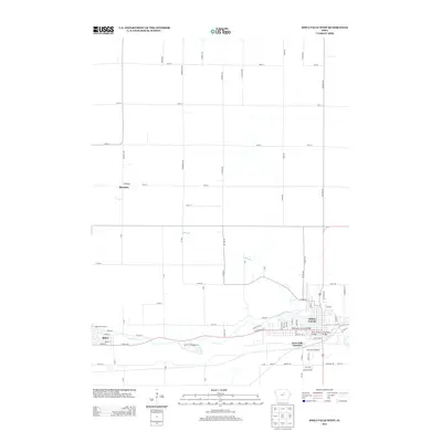
2013 Map of Iowa Falls West
USGS Topo · Published 2013About this map
The Iowa River carves a winding path through this Hardin County landscape, connecting the industrial and residential centers of Iowa Falls and Alden. This 2013 survey reveals a transition from the dense street grids of the riverside towns to the expansive agricultural sections defined by an orderly network of rural roads like Indigo Ave and 60th St. In the southeastern corner, Iowa Falls Junction highlights the intersection of rail and road infrastructure that supported the region's commerce. Smaller watercourses such as Elk Run drain the northern fields, while recreational sites like the Alden River Access and Circle C Campground provide public gateways to the river. To the northwest, the small settlement of Burdette stands as a point of interest for local historians, situated amidst the high-ground acreage away from the river valley.
Find a feature on this map
75 named features on this map. Tap any name to fly to it.
Don’t see what you’re looking for? This feature index may not catch every label — zoom into the map to look around manually.
Map Details
Editions of this 2013 Iowa Falls West Map
This is the sole edition of this map. No revisions or reprints were ever made.
Other maps of this area

1954 · Waterloo
USGS Topo · 1:250,000

1955 · Waterloo
USGS Topo · 1:250,000

1979 · Dows East
USGS Topo · 1:24,000

1979 · Coulter
USGS Topo · 1:24,000

1979 · Iowa Falls West
USGS Topo · 1:24,000

1979 · Buckeye West
USGS Topo · 1:24,000

1979 · Buckeye East
USGS Topo · 1:24,000

1979 · Popejoy
USGS Topo · 1:24,000

1979 · Iowa Falls East
USGS Topo · 1:24,000
1979 · Hampton South
USGS Topo · 1:24,000