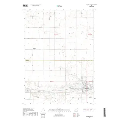
2018 Map of Iowa Falls West
USGS Topo · Published 2018About this map
The Iowa River carves a deep path through the southern half of this Hardin County landscape, dictating the development of the river towns of Iowa Falls and Alden. In the late 2010s, this area maintains its distinct rural-industrial character, where the river is spanned by vital crossings such as the Washington Avenue Bridge and the River Street Bridge. These structural landmarks connect the northern residential and civic sectors of the city to the more industrial corridors south of the water.
Find a feature on this map
62 named features on this map. Tap any name to fly to it.
Don’t see what you’re looking for? This feature index may not catch every label — zoom into the map to look around manually.
Map Details
Editions of this 2018 Iowa Falls West Map
This is the sole edition of this map. No revisions or reprints were ever made.
Other maps of this area

1954 · Waterloo
USGS Topo · 1:250,000

1955 · Waterloo
USGS Topo · 1:250,000

1979 · Dows East
USGS Topo · 1:24,000

1979 · Coulter
USGS Topo · 1:24,000

1979 · Iowa Falls West
USGS Topo · 1:24,000

1979 · Buckeye West
USGS Topo · 1:24,000

1979 · Buckeye East
USGS Topo · 1:24,000

1979 · Popejoy
USGS Topo · 1:24,000

1979 · Iowa Falls East
USGS Topo · 1:24,000
1979 · Hampton South
USGS Topo · 1:24,000