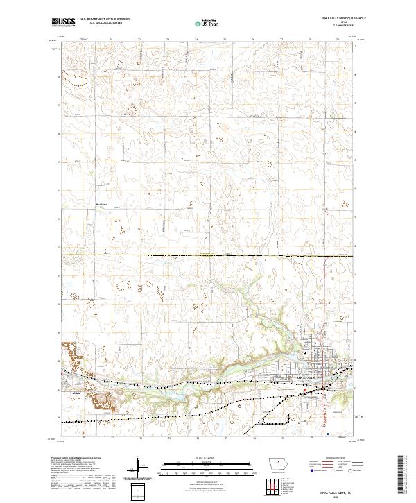
2022 Map of Iowa Falls West
USGS Topo · Published 2022About this map
The Iowa River winds through the southern portion of this region, serving as the primary geographical anchor for the communities of Alden and Iowa Falls. This area on the border of Franklin and Hardin counties exhibits a strictly organized section-line grid of roads, such as Co Hwy S25 and Co Rd C73, which define the agricultural landscape. The small settlement of Burdette stands in the northwestern reaches, while the southeastern corner is dominated by the expansion of Iowa Falls. Educational and civic landmarks like Ellsworth Community College and Union Cem are prominent near the river, reflecting the long-established social infrastructure of these riverside towns. North of the river, the terrain is characterized by the drainage of Elk Run and a network of named avenues like Ironwood Ave and Lark Ave that facilitate the transport of the region's agricultural output.
Find a feature on this map
121 named features on this map. Tap any name to fly to it.
Don’t see what you’re looking for? This feature index may not catch every label — zoom into the map to look around manually.
Map Details
Editions of this 2022 Iowa Falls West Map
This is the sole edition of this map. No revisions or reprints were ever made.
Other maps of this area

1954 · Waterloo
USGS Topo · 1:250,000

1955 · Waterloo
USGS Topo · 1:250,000

1979 · Dows East
USGS Topo · 1:24,000

1979 · Coulter
USGS Topo · 1:24,000

1979 · Iowa Falls West
USGS Topo · 1:24,000

1979 · Buckeye West
USGS Topo · 1:24,000

1979 · Buckeye East
USGS Topo · 1:24,000

1979 · Popejoy
USGS Topo · 1:24,000

1979 · Iowa Falls East
USGS Topo · 1:24,000
1979 · Hampton South
USGS Topo · 1:24,000