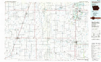
1985 Map of Iowa Great Lakes
USGS Topo · Published 1985About this map
Glacial lakes and wetlands define this Northwest Iowa landscape as it appeared in the mid-1980s, where recreational communities like Arnolds Park and Okoboji sit alongside vast conservation tracts. The map reveals an intricate network of protected lands, including the Spirit Lake State Wildlife Management Area and Gull Point State Park, protecting the shoreline and marsh habitats of the Iowa Great Lakes region.
Find a feature on this map
145 named features on this map. Tap any name to fly to it.
Don’t see what you’re looking for? This feature index may not catch every label — zoom into the map to look around manually.
Map Details
Editions of this 1985 Iowa Great Lakes Map
2 editions found
Other maps of this area

1954 · Fairmont
USGS Topo · 1:250,000

1954 · Fort Dodge
USGS Topo · 1:250,000

1955 · Sioux City
USGS Topo · 1:250,000

1955 · Sioux Falls
USGS Topo · 1:250,000

1957 · Fort Dodge
USGS Topo · 1:250,000

1958 · Sioux City
USGS Topo · 1:250,000

1958 · Sioux Falls
USGS Topo · 1:250,000

1958 · Fort Dodge
USGS Topo · 1:250,000

1958 · Fairmont
USGS Topo · 1:250,000

1959 · Sioux City
USGS Topo · 1:250,000