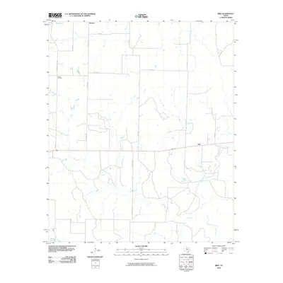
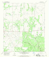
2010 Map of Irby
USGS Topo · Published 2010About this map
Irby and Mattson anchor this agricultural landscape in Haskell County, where the plains are etched by several drainage systems. The survey reveals a network of county and farm-to-market roads that follow the rigid section lines of the Texas Panhandle region, providing access to isolated homesteads and ranch lands. In the northwest corner, the Roberts Cemetery sits along its namesake Roberts Cemetary Rd, serving as a vital landmark for genealogists and local historians. The natural geography is defined by the winding paths of Red Creek, Miller Creek, North Paint Creek, and Horse Creek, which break the geometric regularity of the surveyed road grid. This 2010 edition by the U.S. Geological Survey serves as a clear record of rural infrastructure, showing the persistence of small settlements like Irby long after the initial ranching booms of the early twentieth century.
Find a feature on this map
19 named features on this map. Tap any name to fly to it.
Don’t see what you’re looking for? This feature index may not catch every label — zoom into the map to look around manually.
Map Details
Editions of this 2010 Irby Map
This is the sole edition of this map. No revisions or reprints were ever made.
Other maps of this area

1954 · Wichita Falls
USGS Topo · 1:250,000

1958 · Wichita Falls
USGS Topo · 1:250,000

1962 · Antelope Creek SW
USGS Topo · 1:24,000

1965 · Reynolds Bend NW
USGS Topo · 1:24,000
1966 · Hoover Mountain
USGS Topo · 1:24,000

1966 · Haskell
USGS Topo · 1:24,000
1966 · Lake Stamford East
USGS Topo · 1:24,000
1966 · Lake Stamford West
USGS Topo · 1:24,000
1966 · Irby
USGS Topo · 1:24,000

1967 · Weinert
USGS Topo · 1:24,000