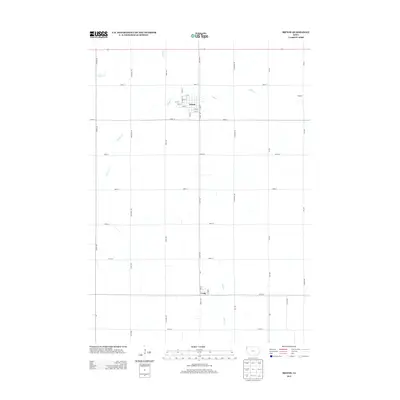
2013 Map of Ireton
USGS Topo · Published 2013About this map
Ireton serves as the primary hub of this Sioux County landscape, featuring a traditional grid of numbered streets from 1st St down to 8th St, intersected by Main St. This survey, produced by the U.S. Geological Survey, illustrates a highly organized agricultural region defined by a rigid section-line road network. The rural character is punctuated by smaller settlements like Craig to the south and the locale of Oshkosh to the northeast. Drainage for the surrounding farmland is provided by a series of watercourses including Spring Cr, Indian Cr, and Mink Cr, which carve subtle paths through the township. The infrastructure is marked by named thoroughfares such as Eagle Ave and Dogwood Ave, reflecting the systematic settlement patterns of the Iowa prairie.
Find a feature on this map
44 named features on this map. Tap any name to fly to it.
Don’t see what you’re looking for? This feature index may not catch every label — zoom into the map to look around manually.
Map Details
Editions of this 2013 Ireton Map
This is the sole edition of this map. No revisions or reprints were ever made.
Other maps of this area

1955 · Sioux City
USGS Topo · 1:250,000

1955 · Sioux Falls
USGS Topo · 1:250,000

1958 · Sioux City
USGS Topo · 1:250,000

1958 · Sioux Falls
USGS Topo · 1:250,000

1959 · Sioux City
USGS Topo · 1:250,000

1962 · Le Mars
USGS Topo · 1:62,500

1964 · Sioux Center
USGS Topo · 1:24,000
1968 · Hawarden North
USGS Topo · 1:24,000

1968 · Labanon
USGS Topo · 1:24,000
1969 · Ireton
USGS Topo · 1:24,000