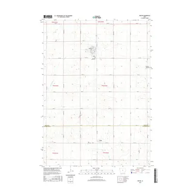
2015 Map of Ireton
USGS Topo · Published 2015About this map
Ireton sits at the heart of this agricultural landscape in Sioux County, where the regular grid of section lines and gravel roads defines the settlement pattern of the western Iowa prairie. This modern survey illustrates a well-established rural infrastructure, anchored by the town of Craig near the southern border and a network of named streams such as Indian Cr and Mink Cr. The area is characterized by its numerous historic burial grounds, which offer significant genealogical value for local families. These include Pleasant Hill Cem, Saint Pauls Lutheran Cem, and the Saint Johns Evangelical Lutheran Cem further east. The persistence of these sites alongside the Dunkard Cem suggests a deeply rooted community history tied to the surrounding farmsteads and township roads like Co RD b58 and Co HWY k30.
Find a feature on this map
46 named features on this map. Tap any name to fly to it.
Don’t see what you’re looking for? This feature index may not catch every label — zoom into the map to look around manually.
Map Details
Editions of this 2015 Ireton Map
This is the sole edition of this map. No revisions or reprints were ever made.
Other maps of this area
1955 · Sioux City
USGS Topo · 1:250,000
1955 · Sioux Falls
USGS Topo · 1:250,000
1958 · Sioux City
USGS Topo · 1:250,000
1958 · Sioux Falls
USGS Topo · 1:250,000
1959 · Sioux City
USGS Topo · 1:250,000
1962 · Le Mars
USGS Topo · 1:62,500
1964 · Sioux Center
USGS Topo · 1:24,000
1968 · Hawarden North
USGS Topo · 1:24,000
1968 · Labanon
USGS Topo · 1:24,000
1969 · Ireton
USGS Topo · 1:24,000