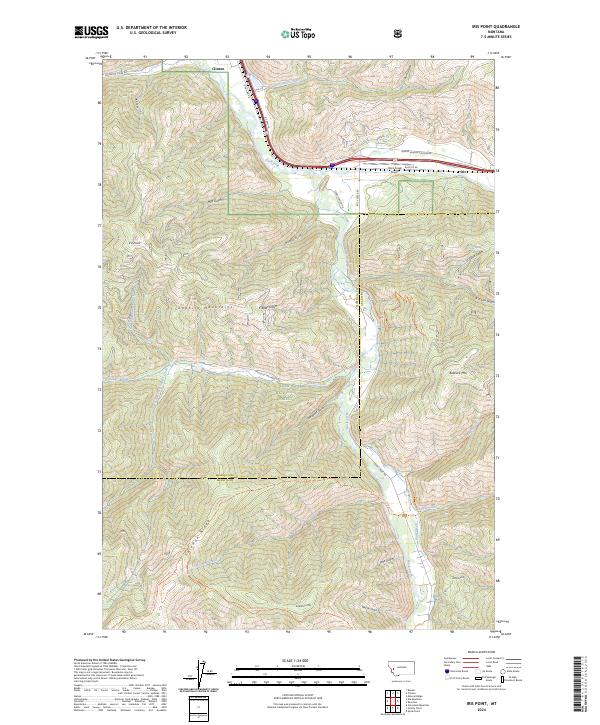
2024 Map of Iris Point
USGS Topo · Published 2024About this map
Iris and Clinton sit at the northern edge of this high-country landscape where the Clark Fork river meets the canyon mouth of Rock Creek. The terrain is defined by the steep elevation gains of the Sapphire Mountains, stretching from the river valley floor up to prominent summits like Iris Point and Babcock Mountain. Significant portions of the land are managed under the Lolo National Forest and the protected Welcome Creek Wilderness, preserving a network of drainage gulches and ridges. Cultural and transport history is visible in the alignment of US Hwy 10 and the Rock Creek Airport near the confluence. A series of forest trails, including the Solomon Ridge Trl and Sawmill Ridge Trl, navigate the complex topography of the Solomon Ridge and southern peaks, illustrating the area's transition from a developed river corridor to a remote wilderness interior.
Find a feature on this map
59 named features on this map. Tap any name to fly to it.
Don’t see what you’re looking for? This feature index may not catch every label — zoom into the map to look around manually.
Map Details
Editions of this 2024 Iris Point Map
This is the sole edition of this map. No revisions or reprints were ever made.
Other maps of this area

1903 · Bonner
USGS Topo · 1:125,000

1947 · Butte
USGS Topo · 1:250,000

1958 · Butte
USGS Topo · 1:250,000

1959 · Cleveland Mountain
USGS Topo · 1:62,500

1959 · Ravenna
USGS Topo · 1:62,500

1960 · Butte
USGS Topo · 1:250,000

1962 · Butte
USGS Topo · 1:250,000
1965 · Clinton
USGS Topo · 1:24,000
1965 · Mineral Ridge
USGS Topo · 1:24,000
1965 · Bonner
USGS Topo · 1:24,000