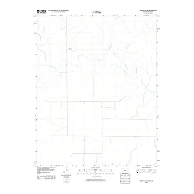
2010 Map of Irish Flats SE
USGS Topo · Published 2010About this map
The Lutheran Cemetery sits as a solitary waypoint in the northern reaches of this Beaver County landscape, where the prairie is defined by a sparse grid of section-line roads and winding drainages. The hydrology of the area is dominated by the meandering course of Crooked Creek, which snakes across the western and central portions of the map, while Remuda Creek flows through the northeast. This 2010 survey illustrates the rigid organization of the High Plains, where human activity is channeled along a network of named routes such as 18 Rd, Dd Rd, and Ff Rd. The absence of large-scale development highlights the area's agricultural character, preserved in a digital age survey that remains focused on the essential intersections of water and land ownership.
Find a feature on this map
12 named features on this map. Tap any name to fly to it.
Don’t see what you’re looking for? This feature index may not catch every label — zoom into the map to look around manually.
Map Details
Editions of this 2010 Irish Flats SE Map
This is the sole edition of this map. No revisions or reprints were ever made.
Other maps of this area

1892 · Meade
USGS Topo · 1:125,000

1954 · Perryton
USGS Topo · 1:250,000

1955 · Dodge City
USGS Topo · 1:250,000

1958 · Perryton
USGS Topo · 1:250,000

1958 · Dodge City
USGS Topo · 1:250,000

1959 · Dodge City
USGS Topo · 1:250,000

1962 · Irish Flats NE
USGS Topo · 1:24,000

1962 · Irish Flats SE
USGS Topo · 1:24,000

1963 · Lake Larrabee
USGS Topo · 1:24,000

1963 · Irish Flats
USGS Topo · 1:24,000