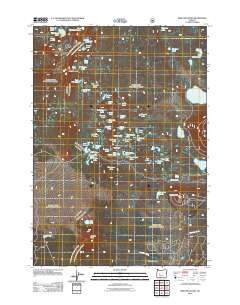
2011 Map of Irish Mountain
USGS Topo · Published 2011About this map
Irish Mountain and Pillar Peak anchor a high-altitude landscape defined by a dense concentration of alpine waters in Lane County. This 2011 survey details a complex network of small lakes and ponds, including Winopee Lake, McFarland Lake, and Teddy Lake, which characterize the terrain between these summits. The map provides clear evidence of the area's recreational geography, showing the Harralson Horse Camp near the western edge and Clover Meadow to the south. Transportation is primarily represented by Waldo Lake Rd, which provides the main access point through the timbered heights. The distribution of features like Lemish Butte and Charlton Butte suggests a volcanic topography where water collects in the depressions of a complex mountain plateau.
Find a feature on this map
59 named features on this map. Tap any name to fly to it.
Don’t see what you’re looking for? This feature index may not catch every label — zoom into the map to look around manually.
Map Details
Editions of this 2011 Irish Mountain Map
This is the sole edition of this map. No revisions or reprints were ever made.
Other maps of this area
1925 · Waldo Lake
USGS Topo · 1:125,000
1930 · Maiden Peak
USGS Topo · 1:125,000
1934 · Maiden Peak
USGS Topo · 1:125,000
1955 · Chucksney Mtn
USGS Topo · 1:62,500

1955 · Crescent
USGS Topo · 1:250,000
1956 · Waldo Lake
USGS Topo · 1:62,500

1957 · Crescent
USGS Topo · 1:250,000

1958 · Crescent
USGS Topo · 1:250,000

1958 · Roseburg
USGS Topo · 1:250,000

1959 · Roseburg
USGS Topo · 1:250,000