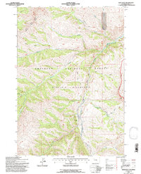
1991 Map of Irish Rock
USGS Topo · Published 1997About this map
Shoshone National Forest and the protected lands of the Washakie Wilderness define this high-altitude landscape in Park County. The Greybull River serves as a central drainage, fed by a network of steep tributaries including Venus Creek and Stuart Creek. Human presence in this remote terrain is marked primarily by isolated structures like the Venus Creek Cabin and a system of rugged pack routes such as the Boulder Basin Trail and the Haymaker Timber Trail. The map documents a strictly managed wilderness environment where the lack of developed roads reflects the area's conservation status. Notable landmarks like Irish Rock and the Wapiti Greybull Ranger District boundaries illustrate the administrative and geological character of the Absaroka Range during the late twentieth century.
Find a feature on this map
21 named features on this map. Tap any name to fly to it.
Don’t see what you’re looking for? This feature index may not catch every label — zoom into the map to look around manually.
Map Details
Editions of this 1991 Irish Rock Map
2 editions found
Other maps of this area

1893 · Ishawooa
USGS Topo · 1:125,000

1895 · Ishawooa
USGS Topo · 1:125,000

1899 · Ishawooa
USGS Topo · 1:125,000

1904 · Kirwin
USGS Topo · 1:125,000

1905 · Younts Peak
USGS Topo · 1:125,000

1906 · Kirwin
USGS Topo · 1:125,000

1907 · Younts Peak
USGS Topo · 1:125,000

1955 · Cody
USGS Topo · 1:250,000

1955 · Thermopolis
USGS Topo · 1:250,000

1956 · Emerald Lake
USGS Topo · 1:24,000