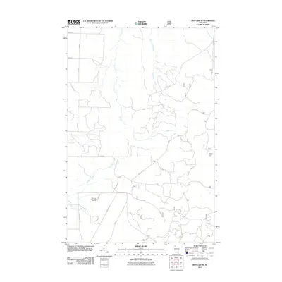
2011 Map of Iron Lake NE
USGS Topo · Published 2011About this map
Iron River National Fish Hatchery anchors the southwestern portion of this landscape, situated near the headwaters of Schacte Creek and the East Fork Iron River. This 2011 survey illustrates a region defined by its hydrological network, where the Flag River and its tributaries carve north through a dense grid of rural roads and forest service tracks. The terrain's elevation and strategic overlooks are marked by the Lenawee Lookout Tower in the east, providing a high-ground perspective over the surrounding woodlands and the upper reaches of the Cranberry River. Numerous family-named routes, such as Hjalmer Rd, Sonenson Rd, and E Simpson Rd, suggest a legacy of local landholding and forest management that persisted into the early 21st century. The map also traces intricate forest access routes like Battle Axe Rd and Slowbridge Rd, which navigate the drainage basins of the Lake Superior watershed.
Find a feature on this map
34 named features on this map. Tap any name to fly to it.
Don’t see what you’re looking for? This feature index may not catch every label — zoom into the map to look around manually.
Map Details
Editions of this 2011 Iron Lake NE Map
This is the sole edition of this map. No revisions or reprints were ever made.
Other maps of this area

1943 · Port Wing
USGS Topo · 1:48,000

1943 · Iron Lake
USGS Topo · 1:48,000

1944 · Moquah
USGS Topo · 1:48,000

1944 · Cornucopia
USGS Topo · 1:48,000

1946 · Cornucopia
USGS Topo · 1:48,000

1946 · Port Wing
USGS Topo · 1:48,000

1947 · Moquah
USGS Topo · 1:48,000

1947 · Iron Lake
USGS Topo · 1:48,000

1953 · Ashland
USGS Topo · 1:250,000

1958 · Ashland
USGS Topo · 1:250,000