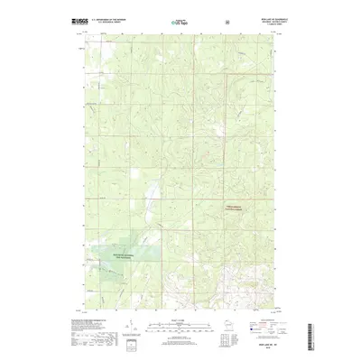
2018 Map of Iron Lake NE
USGS Topo · Published 2018About this map
The Iron River National Fish Hatchery anchors the southwestern portion of this landscape, situated near the headwaters of the E Fork Iron River and Middle Cr. This area of Bayfield County is characterized by a dense network of watercourses, including the Flag River and its eastern fork, which carve through the heavily timbered terrain of the Chequamegon National Forest. The map reveals a specialized transportation network consisting of forest service roads like Battleax Grade and recreational paths such as the Blue Trail and Red Trail. These routes, alongside numerous family-named roads such as Hjalmer Rd and Mcinerney Rd, reflect a region defined by federal conservation management, local timber heritage, and watershed protection in the Lake Superior drainage basin.
Find a feature on this map
32 named features on this map. Tap any name to fly to it.
Don’t see what you’re looking for? This feature index may not catch every label — zoom into the map to look around manually.
Map Details
Editions of this 2018 Iron Lake NE Map
This is the sole edition of this map. No revisions or reprints were ever made.
Other maps of this area

1943 · Port Wing
USGS Topo · 1:48,000

1943 · Iron Lake
USGS Topo · 1:48,000

1944 · Moquah
USGS Topo · 1:48,000

1944 · Cornucopia
USGS Topo · 1:48,000

1946 · Cornucopia
USGS Topo · 1:48,000

1946 · Port Wing
USGS Topo · 1:48,000

1947 · Moquah
USGS Topo · 1:48,000

1947 · Iron Lake
USGS Topo · 1:48,000

1953 · Ashland
USGS Topo · 1:250,000

1958 · Ashland
USGS Topo · 1:250,000