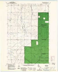
1961 Map of Iron Lake NE
USGS Topo · Published 1985About this map
The Flag River cuts through this northern Wisconsin landscape, winding through a region heavily defined by federal conservation efforts. As indicated by the extensive green shading of the Chequamegon National Forest, much of the area is managed under the Washburn Ranger District, reflecting the mid-20th-century focus on forest restoration and public land management. Evidence of the region's industrial past is visible in the presence of an Old Railroad Grade that once served the logging industry, and scattered Gravel Pits that suggest local infrastructure development.
Find a feature on this map
7 named features on this map. Tap any name to fly to it.
Don’t see what you’re looking for? This feature index may not catch every label — zoom into the map to look around manually.
Map Details
Editions of this 1961 Iron Lake NE Map
This is the sole edition of this map. No revisions or reprints were ever made.
Other maps of this area

1943 · Port Wing
USGS Topo · 1:48,000

1943 · Iron Lake
USGS Topo · 1:48,000

1944 · Moquah
USGS Topo · 1:48,000

1944 · Cornucopia
USGS Topo · 1:48,000

1946 · Cornucopia
USGS Topo · 1:48,000

1946 · Port Wing
USGS Topo · 1:48,000

1947 · Moquah
USGS Topo · 1:48,000

1947 · Iron Lake
USGS Topo · 1:48,000

1953 · Ashland
USGS Topo · 1:250,000

1958 · Ashland
USGS Topo · 1:250,000