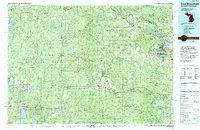
1991 Map of Iron Mountain
USGS Topo · Published 1991About this map
The Potawatomi Indian Reservation and the extensive timberlands of the Nicolet National Forest dominate this borderland landscape at the close of the twentieth century. Industrial activity is centered on the Menominee River corridor, where the twin cities of Iron Mountain and Kingsford serve as regional hubs for the iron and timber economy. Evidence of the region’s deep mining roots is visible at the Bradley Mine and Trader Mine, while the Soo Line railroad connects smaller timber towns like Goodman, Laona, and Cavour across the Wisconsin interior. The confluence of the Brule River and the Menominee River marks the boundary between Michigan and Wisconsin, a waterway that historically facilitated the movement of logs from the northern woods to the mills of Niagara and Aurora.
Find a feature on this map
59 named features on this map. Tap any name to fly to it.
Don’t see what you’re looking for? This feature index may not catch every label — zoom into the map to look around manually.
Map Details
Editions of this 1991 Iron Mountain Map
This is the sole edition of this map. No revisions or reprints were ever made.
Other maps of this area

1898 · Iron River
USGS Topo · 1:62,500

1899 · Sagola
USGS Topo · 1:62,500

1899 · Crystal Falls
USGS Topo · 1:62,500

1928 · Three Lakes
USGS Topo · 1:48,000

1938 · Phelps
USGS Topo · 1:48,000

1938 · Alvin
USGS Topo · 1:48,000

1938 · Three Lakes
USGS Topo · 1:48,000

1939 · Pembine
USGS Topo · 1:48,000

1939 · Dunbar
USGS Topo · 1:48,000

1939 · Crandon
USGS Topo · 1:48,000