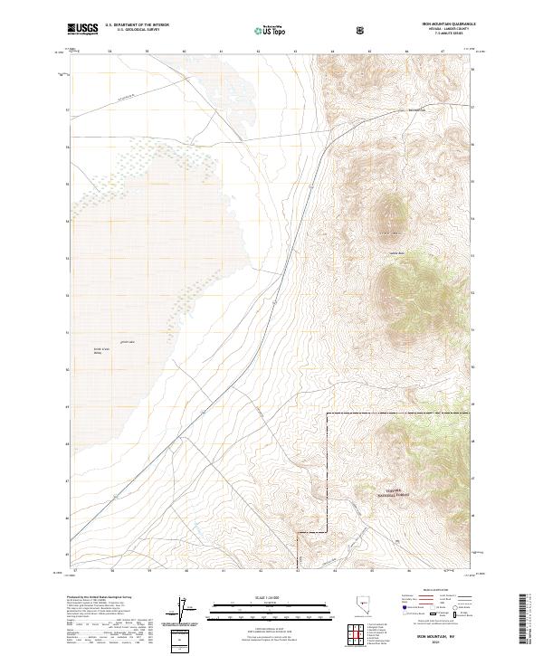
2021 Map of Iron Mountain
USGS Topo · Published 2021About this map
Toiyabe National Forest dominates the eastern portion of this map, where the high ridges of Iron Mtn and the Saddle Back divide the high country from the basin floor. To the west, the landscape transitions into the Smith Creek Valley, a broad expanse characterized by intermittent water features like Smith Lake. The presence of the Old Overland Rd in the north serves as a tangible link to historical western migration and freighting routes through this portion of Lander County.
Find a feature on this map
16 named features on this map. Tap any name to fly to it.
Don’t see what you’re looking for? This feature index may not catch every label — zoom into the map to look around manually.
Map Details
Editions of this 2021 Iron Mountain Map
This is the sole edition of this map. No revisions or reprints were ever made.
Other maps of this area

1955 · Millett
USGS Topo · 1:250,000

1956 · South Shoshone Peak
USGS Topo · 1:62,500

1956 · North Shoshone Peak
USGS Topo · 1:62,500

1959 · Millett
USGS Topo · 1:250,000

1969 · Gandolfo Canyon
USGS Topo · 1:24,000

1969 · Emigrant Peak
USGS Topo · 1:24,000

1969 · Dutch Flat
USGS Topo · 1:24,000

1969 · Carroll Summit NE
USGS Topo · 1:24,000

1969 · Iron Mountain
USGS Topo · 1:24,000
1969 · Carroll Summit SE
USGS Topo · 1:24,000