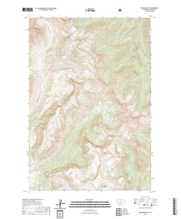
2024 Map of Iron Mountain
USGS Topo · Published 2024About this map
Iron Mtn and the surrounding high country of the Absaroka Range dominate this high-elevation landscape within the Gallatin National Forest. The area is defined by a complex drainage network where the headwaters of Hellroaring Creek and its various branches, such as Middle Fork Hellroaring Creek and East Fork Hellroaring Creek, carve through the mountainous terrain. Most of the territory is protected as part of the Absaroka-Beartooth Wilderness, accessible primarily through a system of primitive routes including the West Fork Hellroaring Trl and Buffalo Fork Trl. At the eastern edge, the Boulder River flows through a narrow corridor alongside Natl Forest Develop Road 6639 Rd. This map captures a preserved alpine ecosystem featuring Elk Lake and the sequestered Hummingbird Basin, illustrating the hydrographic divide created by landmarks like Middle Ridge.
Find a feature on this map
33 named features on this map. Tap any name to fly to it.
Don’t see what you’re looking for? This feature index may not catch every label — zoom into the map to look around manually.
Map Details
Editions of this 2024 Iron Mountain Map
This is the sole edition of this map. No revisions or reprints were ever made.
Other maps of this area

1891 · Livingston
USGS Topo · 1:250,000

1893 · Livingston
USGS Topo · 1:250,000

1940 · Mt. Cowen
USGS Topo · 1:62,500

1940 · Mt Wallace
USGS Topo · 1:62,500

1941 · Mt Douglas
USGS Topo · 1:62,500

1942 · Cutoff Mtn
USGS Topo · 1:62,500

1943 · Mt Wallace
USGS Topo · 1:62,500

1943 · Mt Douglas
USGS Topo · 1:62,500

1943 · Mt Cowen
USGS Topo · 1:62,500

1944 · Cutoff Mtn
USGS Topo · 1:62,500