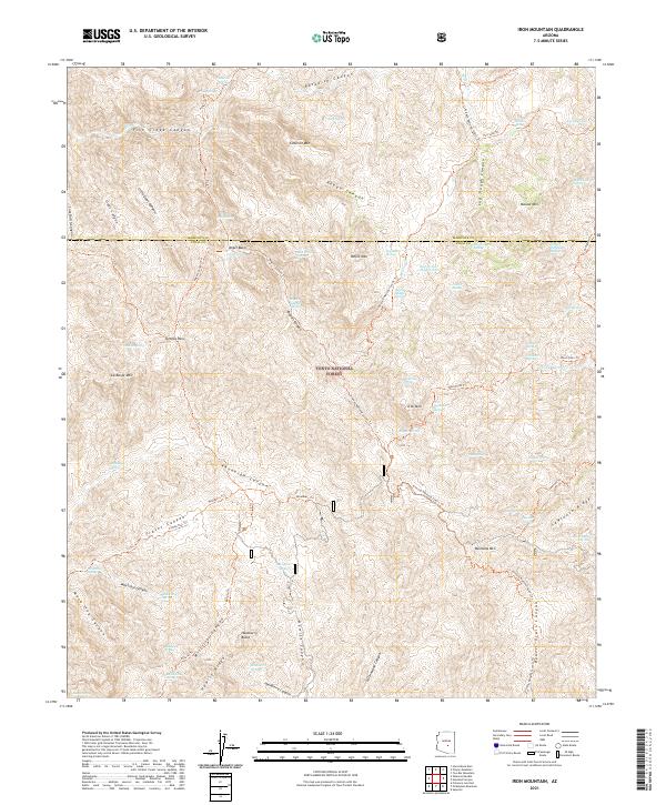
2021 Map of Iron Mountain
USGS Topo · Published 2021About this map
Tonto National Forest land dominates this high-elevation terrain where the border of Maricopa and Pinal counties meets. The landscape is defined by a dense network of canyons and peaks, notably Iron Mtn and Montana Mtn, which serve as anchor points for several historic routes. The Arizona National Scenic Trail winds through the eastern portion of the map, intersecting with numerous secondary paths like the Rogers Canyon Trail and Woodbury Trail. This intricate trail system highlights the area's importance for transit through the mountain passes, connecting isolated water sources such as Angel Spring and Honeycutt Spring. The presence of named geographic features like Hackberry Butte and Angel Basin alongside various cattle-and-horse era springs suggests a long history of seasonal land use and ranching navigation through the deep cuts of Fish Creek Canyon and Hewitt Canyon.
Find a feature on this map
82 named features on this map. Tap any name to fly to it.
Don’t see what you’re looking for? This feature index may not catch every label — zoom into the map to look around manually.
Map Details
Editions of this 2021 Iron Mountain Map
This is the sole edition of this map. No revisions or reprints were ever made.
Other maps of this area

1900 · Florence
USGS Topo · 1:125,000

1902 · Florence
USGS Topo · 1:125,000

1907 · Roosevelt
USGS Topo · 1:125,000

1909 · Four Peaks
USGS Topo · 1:125,000

1912 · Roosevelt
USGS Topo · 1:125,000

1948 · Superior
USGS Topo · 1:62,500

1948 · Superior
USGS Topo · 1:24,000

1948 · Iron Mountain
USGS Topo · 1:24,000
1948 · Haunted Canyon
USGS Topo · 1:24,000

1948 · Picketpost Mtn
USGS Topo · 1:24,000