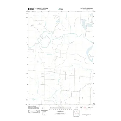
2011 Map of Iron Mountain SW
USGS Topo · Published 2011About this map
Homestead serves as a central point of reference in this Wisconsin and Michigan borderland, where the landscape is defined by the winding paths of the Pine River and the Menominee River. The drainage patterns in this area are complex, with the Little Popple River and its South Branch carving through the southern half of the quadrangle. This 2011 survey captures the network of local roads such as Ellwood Lake Rd and County Hwy-N that connect the numerous water bodies, including Ellwood Lake, Sand Lake, and Hauserman Lake. The distribution of these lakes and creeks reflects the post-glacial topography of the region, providing a detailed look at the hydrology along the state line. Genealogists and local historians can trace the rural road names and land divisions that frame the scattered settlements and natural landmarks throughout this section of Dickinson and Florence counties.
Find a feature on this map
58 named features on this map. Tap any name to fly to it.
Don’t see what you’re looking for? This feature index may not catch every label — zoom into the map to look around manually.
Map Details
Editions of this 2011 Iron Mountain SW Map
This is the sole edition of this map. No revisions or reprints were ever made.
Other maps of this area

1939 · Dunbar
USGS Topo · 1:48,000

1939 · Goodman
USGS Topo · 1:48,000

1939 · Iron Mountain
USGS Topo · 1:48,000

1941 · Florence
USGS Topo · 1:48,000

1941 · Dunbar
USGS Topo · 1:48,000

1941 · Iron Mountain
USGS Topo · 1:48,000

1946 · Goodman
USGS Topo · 1:48,000

1947 · Dunbar
USGS Topo · 1:48,000

1947 · Iron Mountain
USGS Topo · 1:48,000

1947 · Stager
USGS Topo · 1:24,000