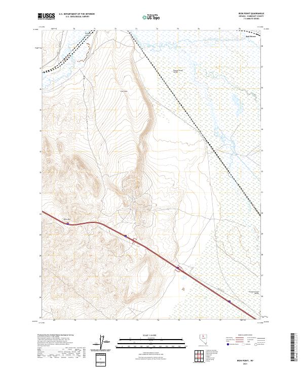
2021 Map of Iron Point
USGS Topo · Published 2021About this map
Humboldt River and its intricate secondary waterway, Herrin Slough, dominate the northern expanse of this Humboldt County landscape. This 2021 survey shows a region defined by sharp topographical contrasts, where the level terrain of Pumpernickel Valley meets the rising slopes of Edna Mtn and the prominent landmark of Iron Point. The small settlement of Red House sits near the northeastern corner, marking a rare point of named habitation in this expansive high-desert environment. Transport corridors including Midas Rd and Froutdag Rd cut through the sagebrush and slough-lands, tracing paths near Emigrant Canyon that have likely served travelers for generations. The map's contour lines reveal the complex drainage patterns feeding into the river system, illustrating how the natural landforms dictate the placement of local infrastructure.
Find a feature on this map
13 named features on this map. Tap any name to fly to it.
Don’t see what you’re looking for? This feature index may not catch every label — zoom into the map to look around manually.
Map Details
Editions of this 2021 Iron Point Map
This is the sole edition of this map. No revisions or reprints were ever made.
Other maps of this area

1882 · Paradise
USGS Topo · 1:250,000

1893 · Paradise
USGS Topo · 1:250,000

1932 · Sonoma Range
USGS Topo · 1:250,000

1939 · Sonoma Range
USGS Topo · 1:250,000

1945 · Osgood Mountains
USGS Topo · 1:62,500

1947 · Osgood Mountains
USGS Topo · 1:62,500

1955 · McDermitt
USGS Topo · 1:250,000

1955 · Winnemucca
USGS Topo · 1:250,000

1958 · Winnemucca
USGS Topo · 1:250,000

1959 · McDermitt
USGS Topo · 1:250,000