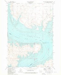
1973 Map of Iron Post Buttes SE
USGS Topo · Published 1973About this map
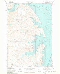
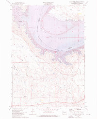
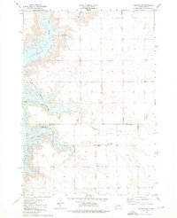
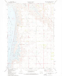
The Missouri River corridor dominates this landscape, having been transformed by the mid-century inundation that created Lake Oahe. This survey provides a rare look at the underwater topography of the riverbed, with contours derived from 1947 USCE maps before the reservoir was filled. The transition from the high, dry draws of Sully Creek and Plum Creek to the submerged river valley illustrates the massive scale of the Oahe Dam project. Along the eastern bluffs, the Old Military Reservation Boundary marks a historical line of land tenure, while contemporary land use is reflected in the Koenig State Public Shooting Area and the Okobojo Recreation Area. In the south, the broad Peoria Flats extend toward the river's edge, broken only by the occasional Gravel Pit and winding drainages like Red Woman Creek.
Find a feature on this map
16 named features on this map. Tap any name to fly to it.
Don’t see what you’re looking for? This feature index may not catch every label — zoom into the map to look around manually.
Map Details
Editions of this 1973 Iron Post Buttes SE Map
This is the sole edition of this map. No revisions or reprints were ever made.
Other maps of this area
1924 · Pierre
USGS Topo · 1:62,500
1937 · Oahe
USGS Topo · 1:62,500

1954 · Pierre
USGS Topo · 1:250,000

1958 · Pierre
USGS Topo · 1:250,000

1965 · Okobojo
USGS Topo · 1:24,000
1973 · Iron Post Buttes SW
USGS Topo · 1:24,000
1973 · Iron Post Buttes
USGS Topo · 1:24,000
1973 · Willow Creek Butte
USGS Topo · 1:24,000
1973 · Okobojo SW
USGS Topo · 1:24,000
1973 · Mail Shack Creek
USGS Topo · 1:24,000