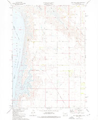
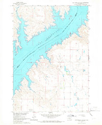
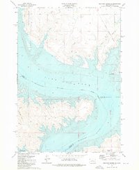
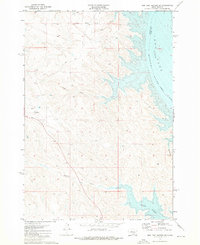
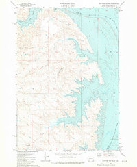
1973 Map of Mail Shack Creek
USGS Topo · Published 1976About this map
Lake Oahe and the Missouri River define the western edge of this central South Dakota landscape, where the water meets the rising elevation of the Sully Buttes. The geography is marked by legacy administrative lines, including the Old Military Reservation Boundary and an Old Treaty Boundary, which intersect the drainage patterns of Mail Shack Creek and Bakers Gulch. A small Trailer Park and an adjacent Gravel Pit appear near the shoreline, indicating localized human activity and resource extraction during this mid-1970s period.
Find a feature on this map
16 named features on this map. Tap any name to fly to it.
Don’t see what you’re looking for? This feature index may not catch every label — zoom into the map to look around manually.
Map Details
Editions of this 1973 Mail Shack Creek Map
This is the sole edition of this map. No revisions or reprints were ever made.
Other maps of this area

1954 · Pierre
USGS Topo · 1:250,000

1958 · Pierre
USGS Topo · 1:250,000
1965 · Artichoke Butte SW
USGS Topo · 1:24,000

1965 · Okobojo
USGS Topo · 1:24,000

1969 · No Heart Creek SE
USGS Topo · 1:24,000

1969 · No Heart Creek SW
USGS Topo · 1:24,000
1973 · Iron Post Buttes SE
USGS Topo · 1:24,000
1973 · Iron Post Buttes SW
USGS Topo · 1:24,000
1973 · Iron Post Buttes
USGS Topo · 1:24,000
1973 · Okobojo SW
USGS Topo · 1:24,000