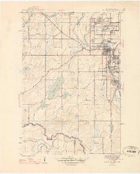
1946 Map of Iron River
USGS Topo · Published 1946About this map
Iron ore mining operations define the landscape of the upper Menominee Range just after World War II, where deep-shaft mines and company-built residential clusters sit alongside established municipalities. The industrial corridor follows the Chicago and Northwestern railroad and the Iron River, connecting the town of Iron River with Stambaugh and Caspian. A distinct pattern of "locations"—company-owned worker housing areas—is evident in settlements like Forbes Location, Homer Location, Hiawatha Location, and Virgil Location, each situated adjacent to their namesake operations like the Forbes Mine or the Homer Mine.
Find a feature on this map
43 named features on this map. Tap any name to fly to it.
Don’t see what you’re looking for? This feature index may not catch every label — zoom into the map to look around manually.
Map Details
Editions of this 1946 Iron River Map
2 editions found
Other maps of this area

1898 · Iron River
USGS Topo · 1:62,500

1938 · Alvin
USGS Topo · 1:48,000

1939 · Long Lake
USGS Topo · 1:48,000

1944 · Iron River
USGS Topo · 1:24,000

1944 · Gaastra
USGS Topo · 1:24,000

1945 · Gibbs City
USGS Topo · 1:24,000

1945 · Sunset Lake
USGS Topo · 1:24,000

1946 · Iron River
USGS Topo · 1:31,680

1946 · Sunset Lake
USGS Topo · 1:31,680

1946 · Gaastra
USGS Topo · 1:31,680