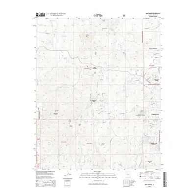
2014 Map of Iron Springs
USGS Topo · Published 2014About this map
Prescott National Forest dominates this landscape, where the high country west of Prescott meets a series of prominent peaks and canyons. The settlement of Iron Springs and the residential area of Highland Park are situated along Iron Springs Rd, illustrating the development of this area as an upland retreat. The topography is defined by significant elevations like Granite Mountain and Thumb Butte, while Granite Basin Lake provides a central water feature amidst the complex drainage systems of Mint Wash and Willow Creek. This map reveals a transition from the denser residential subdivisions like Wildwood Estates and Rancho Vista Estates near the city to the more isolated springs and tanks of the backcountry, such as Contreras Spring and Doce Tank.
Find a feature on this map
107 named features on this map. Tap any name to fly to it.
Don’t see what you’re looking for? This feature index may not catch every label — zoom into the map to look around manually.
Map Details
Editions of this 2014 Iron Springs Map
This is the sole edition of this map. No revisions or reprints were ever made.
Other maps of this area

1887 · Prescott
USGS Topo · 1:250,000

1892 · Prescott
USGS Topo · 1:250,000

1903 · Bradshaw Mountains
USGS Topo · 1:125,000

1903 · Congress
USGS Topo · 1:125,000

1904 · Congress
USGS Topo · 1:125,000

1905 · Jerome
USGS Topo · 1:125,000

1947 · Iron Springs
USGS Topo · 1:62,500

1947 · Mt. Union
USGS Topo · 1:62,500

1947 · Kirkland
USGS Topo · 1:62,500

1947 · Prescott
USGS Topo · 1:62,500