
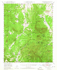
1947 Map of Iron Springs
USGS Topo · Published 1958About this map
The Atchison Topeka and Santa Fe railway winds through the heart of the Prescott National Forest, serving as a vital artery for this ranching and mining region in the late 1940s. The settlement of Iron Springs sits centrally, surrounded by rugged peaks like Granite Mountain and Thumb Butte. This era of land use is defined by a network of established family ranches, including Rancho Moano, American Ranch, and the Bar U Bar Ranch, many of which relied on the numerous springs such as Whiskey Spr and Tonto Spr scattered across the terrain.
Find a feature on this map
77 named features on this map. Tap any name to fly to it.
Don’t see what you’re looking for? This feature index may not catch every label — zoom into the map to look around manually.
Map Details
Editions of this 1947 Iron Springs Map
2 editions found
Other maps of this area

1887 · Prescott
USGS Topo · 1:250,000

1892 · Prescott
USGS Topo · 1:250,000

1903 · Bradshaw Mountains
USGS Topo · 1:125,000

1903 · Congress
USGS Topo · 1:125,000

1904 · Congress
USGS Topo · 1:125,000

1905 · Jerome
USGS Topo · 1:125,000

1947 · Simmons
USGS Topo · 1:62,500

1947 · Mt. Union
USGS Topo · 1:62,500

1947 · Paulden
USGS Topo · 1:62,500

1947 · Kirkland
USGS Topo · 1:62,500