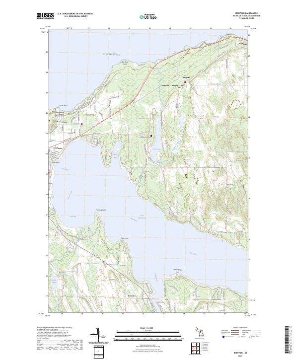
2023 Map of Ironton
USGS Topo · Published 2023About this map
Lake Charlevoix and the surrounding shoreline are defined by a complex network of waterways, where the Pine River and Jordan River meet the South Arm. The landscape is a mix of small coastal settlements like Ironton and Burgess, with the larger community of Charlevoix bordering the western edge near Oyster Bay. A notable cultural landmark is the Greensky Indian Cem near Susan Lake, indicating the deep history of indigenous heritage in the region. The geography is characterized by numerous points and bays, from North Point to Hemingway Point, while the northern coastline meets Lake Michigan at Big Rock Point and Ninemile Point. Extensive trail systems like the North Western State Trl and Pa-Be-Shan TRL weave through the terrain, tracing the paths of earlier transportation routes and modern recreational development along the lake shores.
Find a feature on this map
120 named features on this map. Tap any name to fly to it.
Don’t see what you’re looking for? This feature index may not catch every label — zoom into the map to look around manually.
Map Details
Editions of this 2023 Ironton Map
This is the sole edition of this map. No revisions or reprints were ever made.
Other maps of this area

1954 · Central Lake
USGS Topo · 1:62,500

1954 · Charlevoix
USGS Topo · 1:62,500

1955 · Cheboygan
USGS Topo · 1:250,000

1958 · Cheboygan
USGS Topo · 1:250,000

1958 · Bayshore
USGS Topo · 1:62,500

1961 · Boyne City
USGS Topo · 1:62,500

1975 · Boyne City NW
USGS Topo · 1:24,000

1975 · Boyne City NE
USGS Topo · 1:24,000
1983 · Ellsworth
USGS Topo · 1:25,000
1983 · Forest Beach
USGS Topo · 1:25,000