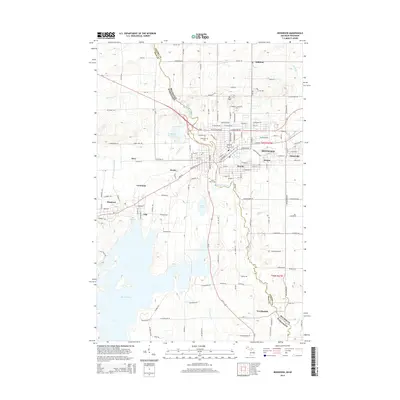
2014 Map of Ironwood
USGS Topo · Published 2014About this map
The Montreal River serves as the primary boundary between Ironwood, Michigan, and Hurley, Wisconsin, anchoring this 2014 survey of the Gogebic Range. This border region is defined by its industrial and social clusters, where neighborhoods like Jessieville, Aurora, and Norrie represent the historical development of the iron mining district. To the north, Mt Zion overlooks the campus of Gogebic Community College, while the expansive Gile Flowage and La Blonde Flowage dominate the southwestern terrain. Cultural and local history is preserved at Riverside Cemetery and Saint Mary's Cemetery, which sit near the river's bend. Further south, the landscape transitions from the urban density of the twin cities to the more isolated settlements of Germania and Van Buskirk, following the winding course of the river through the boundary between Gogebic and Iron counties.
Find a feature on this map
119 named features on this map. Tap any name to fly to it.
Don’t see what you’re looking for? This feature index may not catch every label — zoom into the map to look around manually.
Map Details
Editions of this 2014 Ironwood Map
This is the sole edition of this map. No revisions or reprints were ever made.
Other maps of this area

1940 · Upson
USGS Topo · 1:48,000

1943 · Little Girls Point
USGS Topo · 1:24,000

1943 · Upson
USGS Topo · 1:48,000

1943 · Ironwood
USGS Topo · 1:48,000

1943 · Little Girl Point
USGS Topo · 1:48,000

1953 · Ashland
USGS Topo · 1:250,000

1955 · Ironwood
USGS Topo · 1:24,000

1955 · Bessemer
USGS Topo · 1:24,000

1955 · Ironwood
USGS Topo · 1:62,500

1956 · North Ironwood
USGS Topo · 1:62,500